Arkivo:Relief Map of Poland.svg

Grandezo di la previdado PNG de ica arkivo SVG: 617 x 600 pixels. Altra qualeso, en pixel-i: 247 x 240 pixels | 494 x 480 pixels | 790 x 768 pixels | 1 053 x 1 024 pixels | 2 107 x 2 048 pixels | 861 x 837 pixels.
Arkivo originala (arkivo SVG, nominale 861 x 837 "pixels", kun 4 MB)
Titulo
| Deskripto |
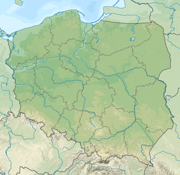
Deutsch: Positionskarte von Polen
Quadratische Plattkarte, N-S-Streckung 160 %. Geographische Begrenzung der Karte:
English: Location map of Poland
Equirectangular projection, N/S stretching 160 %. Geographic limits of the map:
|
| Dato | |
| Fonto |
Propra verko This vector image includes elements that have been taken or adapted from this file: This vector image includes elements that have been taken or adapted from this file: |
| Autoro |
TUBS |
| Altra versioni |
|
| SVG genesis | Ĉi tiu dosiero estas kreita per Adobe Illustrator de TUBS. |


Licencizo
Me, la posedanto dil autoroyuro pri ica imajo/arkivo, permisos lua uzado camaniere:
Ica arkivo liberigesas sub permiso Creative Commons Attribution-Share Alike 3.0 Unported.
- Vu povas:
- partigar – kopiar, distributar e transsendar la verko
- Mixar – adaptar l'arkivo
- Segun la sequanta kondicioni:
- Atribuo – Vu mustas referar l'artiklo o verko segun la formo definita dal autoro o dal proprietero dil autoroyuro, ed informar se modifikuri facesis. Vu mustas facar to per justa formo, ma ne insinuar ke l'autoro konfidis ol a vu, od aprobis vua uzo dil artiklo.
- partigar identa ('share alike') – Se vu modifikos, transformos od augmentos ica verko, vu mustos distributar la rezulto segun la sama, o simila licenco, quale l'originalo.

|
I'd greatly appreciate, that you attribute this media file to Wikimedia Commons, if used outside Wikipedia or Commons. For use in publications such as books, newspapers, blogs, websites, please insert here the following line:
|
Historio dil arkivo
Kliktez sur la dato/horo por vidar arkivo quale ol aparis ye ta tempo.
| Dato/Horo | Miniaturo | Dimensioni | Uzero | Komento | |
|---|---|---|---|---|---|
| aktuala | 23:20, 30 nov. 2021 | | 861 × 837 (4 MB) | Puck04 | fixed SVG code (was "W3C-invalid") + cleanup using text editor; contains raster graphics however |
| 20:54, 3 feb. 2021 |  | 861 × 837 (4,18 MB) | SANtosito | Vectorized topo | |
| 21:52, 30 nov. 2011 |  | 861 × 837 (4,87 MB) | TUBS | == {{int:filedesc}} == {{Information |Description={{en|Relief map of Poland}} Equirectangular projection, N/S stretching 160 %. Geographic limits of the map: * N: 55.2° N * S: 48.7° N * W: 13.8° E * E: 24.5° E |Source={{own}}{{Adobe Il |
Ligilo al imajo
Ca pagini ligas al imajo:
- Aleksandrów Łódzki
- Bełchatów
- Bolimów
- Brzeziny
- Błaszki
- Działoszyn
- Głowno
- Kalino
- Kamieńsk
- Kielce
- Koluszki
- Konstantynów Łódzki
- Kostrzyn nad Odrą
- Kraków
- Kutno
- Lutomiersk
- Lututów
- Opoczno
- Opole
- Ozorków
- Pabianice
- Pajęczno
- Piotrków Trybunalski
- Piątek
- Poddębice
- Radomsko
- Rawa Mazowiecka
- Rzgów
- Sieradz
- Skierniewice
- Szczecin
- Tomaszów Mazowiecki
- Tuszyn
- Uniejów
- Warta
- Wieluń
- Wieruszów
- Wolbórz
- Wronki
- Zawiercie
- Zduńska Wola
- Zgierz
- Zielona Góra
- Złoczew
- Łask
- Łowicz
- Łódź
- Łęczyca
Uzado en altra Wiki
La sequanta Wiki anke uzas ica arkivo:
- Uzado en ab.wikipedia.org
- Uzado en als.wikipedia.org
- Uzado en ar.wikipedia.org
- Uzado en av.wikipedia.org
- Uzado en azb.wikipedia.org
- Uzado en az.wikipedia.org
- Şablon:Yer xəritəsi Polşa
- Əyri meşə
- Slovinski Milli Parkı
- Dzivna boğazı
- Yamno gölü
- Baltik dili
- Şablon:Dil (coğrafiya)
- Şablon:Dil (coğrafiya)/doc
- Xel dili
- Blendovka səhrası
- Morskie Oko gölü
- Belka-Snejna mağarası
- Karsibur adası
- Ambarlar adası
- Qrabovski adası
- Haliç dağı
- Jives gölü
- Rozeve burnu
- Lısa-Gora dağı
- Avqustovskaya puşa
- Tuxolskie borı
- Rastoçe
- Rominten meşəsi
- Solina gölü
- Qartal Yuvası təbiət parkı
- Uzado en ban.wikipedia.org
- Taman Nasional Tatra, Polandia
- Taman Nasional Bieszczady
- Lis taman nasional ring Polandia
- Taman Nasional Wielkopolska
- Taman Nasional Pieniny (Polandia)
- Taman Nasional Gorce
- Taman Nasional Babia Góra
- Taman Nasional Białowieża
- Taman Nasional Biebrza
- Taman Nasional Kampinos
- Taman Nasional Narew
- Taman Nasional Wigry
- Taman Nasional Magura
- Taman Nasional Roztocze
- Taman Nasional Polesie
- Taman Nasional Świętokrzyski
- Taman Nasional Ojców
Videz altra uzadi por ica artiklo.