Arkivo originala(2 048 × 1 307 pixel-i, grandeso dil arkivo: 2,23 MB, MIME type: image/jpeg)
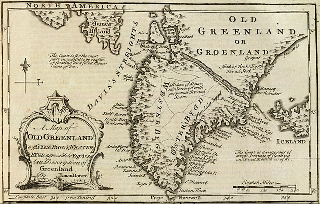
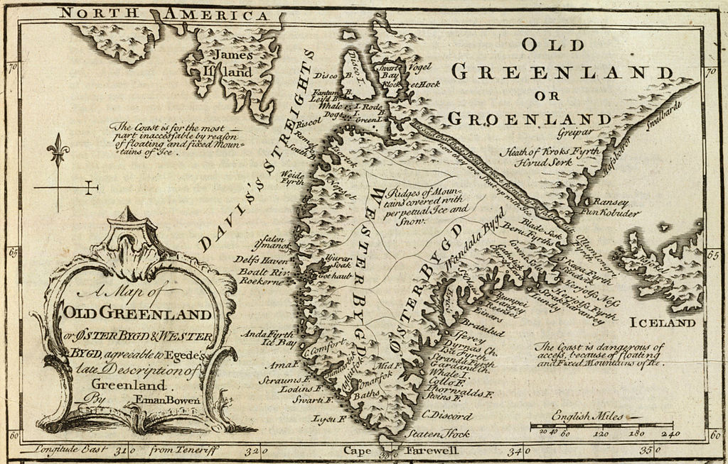
Ca arkivo jacas en Wikimedia Commons, e povas uzesar en altra projeti. La deskriptado en lua pagino di deskriptado montresas adinfre.

Titulo

Deskripto
English: Cropped and rotated from the original.


Original description from the David Rumsey Historical Map Collection:

Author:
Bowen, Emanuel
Date:
1747
Short Title:
Old Greenland.
Publisher:
William Innys [et al.]
London
Type:
Atlas Map
Obj Height cm:
33
Obj Width cm:
23
Scale 1:
9,850,000
Note:
Engraved map. Includes geographic notes and ornamental cartouche. Relief shown pictorially. Ancillary maps [here omitted]: A map of the islands of Ferro or Farro according to Jacobson Debes -- A draught of the Whirlpool, on the south east of Sumbo Rocks wth. the soundings -- An improved map of Iceland. Prime meridian: Teneriffe.
Reference:
P-Maps, p. 303 (1752 ed.); NMM p.356; M&B p 166.
Country:
Greenland; Iceland [here omitted]
Full Title:
A map of old Greenland or Oster Bygd & Wester Bygd, agreeable to Egede's late description of Greenland. By Eman. Bowen. (London: Printed for William Innys, Richard Ware, Aaron Ward, J. and P. Knapton, John Clarke, T. Longman and T. Shewell, Thomas Osborne, Henry Whitridge ... M.DCC.XLVII)
List No:
3733.070
Page No:
No. 71
Series No:
73
Publication Author:
Bowen, Emanuel
Pub Date:
1747
Pub Title:
A complete system of geography. Being a description of all the countries, islands, cities, chief towns, harbours, lakes, and rivers, mountains, mines, &c. of the known world ... In two volumes. The whole illustrated with seventy maps, by Emanuel Bowen, Geographer to His Majesty, being all new-drawn and ingraved according to the latest discoveries and surveys; making, of themselves, a complete atlas, for the sse of gentlemen, merchants, mariners, and others, who delight in history and geography ... Vol. 1. London: Printed for William Innys, Richard Ware, Aaron Ward, J. and P. Knapton, John Clarke, T. Longman and T. Shewell, Thomas Osborne, Henry Whitridge ... M.DCC.XLVII.
Pub Reference:
cf P614 (1752 edition of A Complete Atlas...); NMM p.356; M&B p 166.
Pub Note:
"Preserving all that is useful in the Fourth and Last edition of the Complete Geographer, publish'd under the name of Herman Moll, &c."
Pub List No:
3733.000
Pub Type:
Geography Book
Pub Maps:
70
Pub Height cm:
43
Pub Width cm:
28
Image No:
3733070
Institution:

Rumsey Collection
Dato
Fonto David Rumsey Collection
Autoro Emanuel Bowen (c. 1694–1767)

Licencizo

Ita esas exakta riprodukto fotografala de artoverko bidimensiona qua esas en publika domeno. L'artoverko ipsa esas en publika domeno por la sequanta kauzi:
Public domain

Tiu ĉi verko estas publika havaĵo en tiuj landoj, kies kopirajtado validas por longo de vivo plus 100 jaroj aŭ malpli.


You must also include a United States public domain tag to indicate why this work is in the public domain in the United States.
L'oficala pozeso di Wikimedia Foundation esas ke «exakta riprodukti de artoverki bidimensiona qua esas en publika domeno esas publika domeno».
Ta riprodukto fotografala esas do anke konsiderata esar en publika domeno en l'Unionita Stati di Amerika. Altraresortise, riuzo di ta kozo forsan esar restriktata; videz Riuzo di PD-Artofotografuri por lektar pluse.

Historio dil arkivo

Kliktez sur la dato/horo por vidar arkivo quale ol aparis ye ta tempo.

Dato/HoroMiniaturoDimensioniUzeroKomento
aktuala15:21, 10 may. 2012Imajeto di versiono ye 15:21, 10 may. 20122 048 × 1 307 (2,23 MB)LlywelynII

Ca pagini ligas al imajo:

Uzado en altra Wiki

La sequanta Wiki anke uzas ica arkivo: