Arkivo:George Town Harbour.jpg
Arkivo originala (1 650 × 775 pixel-i, grandeso dil arkivo: 365 KB, MIME type: image/jpeg)
Titulo
| Deskripto |
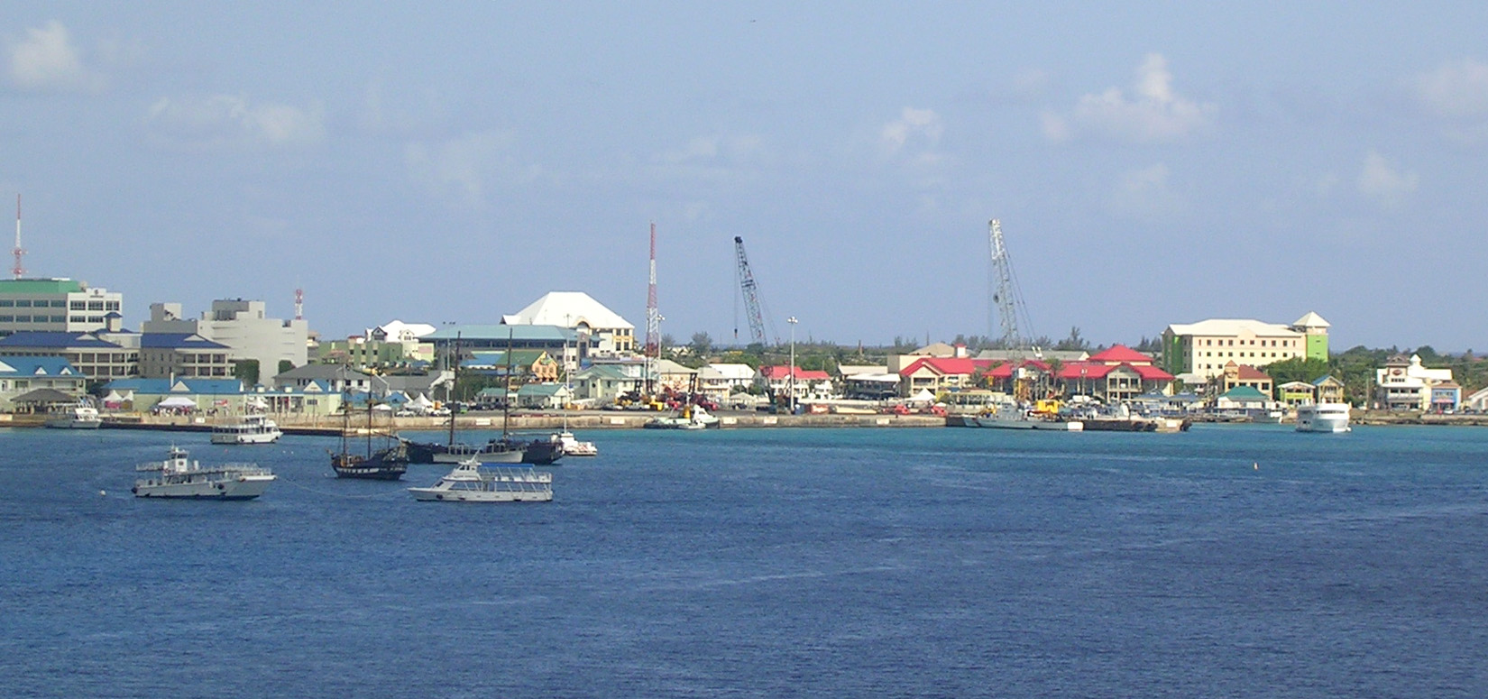
The harbor area of George Town, Grand Cayman, from our cruise ship before our departure. The National Museum is the building with a red roof in the center, just right of the tall, black crane. Our tender landed at the far left, or possibly just to the left of that. The glass bottom boat's home base may be the small green-roofed building in fromt of the large building at the right. The cluster of small ships at the left includes the two "pirate ship" party boats, a George Town tender, and one that I cannot identify at the left. This is not a real panorama, but a single photo with excess sky and water cropped out. |
| Dato | |
| Fonto |
George Town - Panorama from Cruise Ship
|
| Autoro | Roger Wollstadt from Sarasota, Florida |
| Pozicio de la fotilo | | Tiu cxi bildo kaj pliaj sur OpenStreetMap |
|---|
Licencizo
- Vu povas:
- partigar – kopiar, distributar e transsendar la verko
- Mixar – adaptar l'arkivo
- Segun la sequanta kondicioni:
- Atribuo – Vu mustas referar l'artiklo o verko segun la formo definita dal autoro o dal proprietero dil autoroyuro, ed informar se modifikuri facesis. Vu mustas facar to per justa formo, ma ne insinuar ke l'autoro konfidis ol a vu, od aprobis vua uzo dil artiklo.
- partigar identa ('share alike') – Se vu modifikos, transformos od augmentos ica verko, vu mustos distributar la rezulto segun la sama, o simila licenco, quale l'originalo.
| This image, originally posted to Flickr, was reviewed on 24 May 2012 by the administrator or reviewer File Upload Bot (Magnus Manske), who confirmed that it was available on Flickr under the stated license on that date. |
Historio dil arkivo
Kliktez sur la dato/horo por vidar arkivo quale ol aparis ye ta tempo.
| Dato/Horo | Miniaturo | Dimensioni | Uzero | Komento | |
|---|---|---|---|---|---|
| aktuala | 19:29, 24 may. 2012 | | 1 650 × 775 (365 KB) | File Upload Bot (Magnus Manske) | Transferred from Flickr by User:AnonyLog using flickr2commons |
Ligilo al imajo
Ca pagini ligas al imajo:
Uzado en altra Wiki
La sequanta Wiki anke uzas ica arkivo:
- Uzado en de.wikipedia.org
- Uzado en en.wikipedia.org
- Uzado en gl.wikipedia.org
- Uzado en he.wikivoyage.org
- Uzado en hr.wikipedia.org
- Uzado en hy.wikipedia.org
- Uzado en zh.wikipedia.org