Arkivo:Belarus adm location map.svg

Arkivo originala (arkivo SVG, nominale 1 626 x 1 451 "pixels", kun 238 KB)
Titulo
| Deskripto |
Deutsch: Positionskarte von Weißrussland
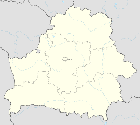
English: Location map of Belarus
|
||||||||||||
| Dato | |||||||||||||
| Fonto |
Own work using:
|
||||||||||||
| Autoro | NordNordWest | ||||||||||||
| SVG genesis | Ĉi tiu dosiero estas kreita per Adobe Illustrator.
|
||||||||||||

Licencizo
Usage of this file with:

explanatory notes: Legally binding is only the full legalcode. For a free usage I recommend to respect the following licence conditions:
1. Provide my name as given above: NordNordWest,
2. a copy of, or the URI for, the applicable license: https://creativecommons.org/licenses/by-sa/3.0/de/legalcode,
3. the title of the work,
4. in the case of an adaptation, a credit identifying the use of the work in the adaptation.
This license and the rights granted hereunder will terminate automatically upon any breach by you of the terms of this license. Any of the above conditions can be waived if you get permission from the copyright holder. If you have questions or wish differing conditions, please contact me through nnwest or my discussion page ![]() t-online.de
t-online.de
- Vu povas:
- partigar – kopiar, distributar e transsendar la verko
- Mixar – adaptar l'arkivo
- Segun la sequanta kondicioni:
- Atribuo – Vu mustas referar l'artiklo o verko segun la formo definita dal autoro o dal proprietero dil autoroyuro, ed informar se modifikuri facesis. Vu mustas facar to per justa formo, ma ne insinuar ke l'autoro konfidis ol a vu, od aprobis vua uzo dil artiklo.
- partigar identa ('share alike') – Se vu modifikos, transformos od augmentos ica verko, vu mustos distributar la rezulto segun la sama, o simila licenco, quale l'originalo.

Historio dil arkivo
Kliktez sur la dato/horo por vidar arkivo quale ol aparis ye ta tempo.
| Dato/Horo | Miniaturo | Dimensioni | Uzero | Komento | |
|---|---|---|---|---|---|
| aktuala | 09:51, 6 may. 2016 | | 1 626 × 1 451 (238 KB) | NordNordWest | c |
| 16:52, 5 may. 2016 |  | 1 626 × 1 451 (842 KB) | NordNordWest | c | |
| 19:04, 10 sep. 2014 |  | 1 626 × 1 451 (249 KB) | NordNordWest | c | |
| 18:54, 10 sep. 2014 |  | 1 626 × 1 451 (250 KB) | NordNordWest | == {{int:filedesc}} == {{Information |Description= {{de|1=Positionskarte von Weißrussland}} {{en|1=Location map of Belarus}} {{Location map series N |top=56.4 |bottom=51.1 |left=22.9 |right=33.0 }} |Source={{Own using}} * United States National Imager... |
Ligilo al imajo
Plua kam 100 pagini ligesas ad ica arkivo. La sequanta listo montras nur l'unesma 100 ligili ad ica arkivo. Hike la kompleta listo esas disponebla.
- Andronava
- Andrzewshchina (Orsha)
- Anibalieva
- Antonawka (Orsha)
- Arashki
- Arehawsk
- Arlowshchina (Orsha)
- Babichi (Orsha)
- Babinichi (Orsha)
- Balbasava
- Baran
- Baran (Vuscie)
- Barawci (Orsha)
- Barsuki (Orsha)
- Barzdowka
- Bayari (Orsha)
- Bielieva (Orsha)
- Bierascienava
- Brancava
- Brazdziechina
- Bruhava
- Budzishcha (Orsha)
- Charnoye
- Chihirinka
- Chirvonaya Harkawka
- Churilava (Orsha)
- Dachnaya (Bielorusia)
- Dawjanici
- Dzievina
- Halmi (Orsha)
- Harani (Orsha)
- Harkawka (Orsha)
- Hornaya Vieravoisha
- Hrabianiova
- Karabishchi
- Kliukawka
- Kliushnikava
- Kopis
- Krapiwna (Orsha)
- Krashina
- Krasnabiel
- Krasni Bierah (Orsha)
- Kudayeva
- Kushewka
- Lamachina (Orsha)
- Liasni (Orsha)
- Liavonawka (Orsha)
- Lienkavichi
- Lipki (Orsha)
- Lisowskia
- Makarawka (Orsha)
- Malinawka (Orsha)
- Markavichi (Orsha)
- Marozava (Orsha)
- Marozawka (Orsha)
- Mashkova (Orsha)
- Mickawshchina (Orsha)
- Miejava (Orsha)
- Nareikava
- Navasiolki (Orsha)
- Nijniaya Vieravoisha
- Novaye Horabrava
- Orsha
- Padhaishchina
- Panizowie (Babinichi)
- Piechishcha (Orsha)
- Pishchalava
- Pridniaprowie
- Prihuzki
- Puhliai
- Puzirova
- Rahozina (Orsha)
- Ramaldava
- Rumina
- Sciapkova (Orsha)
- Sidarawka (Orsha)
- Smaliani
- Solawie
- Star (Orsha)
- Starina (Orsha)
- Staroye Horabrava
- Stawri
- Sudniki (Orsha)
- Svisciolki
- Tatarsk (Orsha)
- Turavichi (Orsha)
- Turlai
- Vialikaya Mickawshchina
- Viazavaya (Orsha)
- Vieracieya (Orsha)
- Visokaye (agrourbeto, Orsha)
- Vuscie (Orsha)
- Yesipava
- Zabalaccie (Orsha)
- Zadrowie
- Zaharelskia
- Zaicava (Zabalaccie)
- Zaicava (Zadrowie)
- Zaslonawka (Orsha)
- Zubava (Orsha)
Videz plusa ligili ad ica arkivo.
Uzado en altra Wiki
La sequanta Wiki anke uzas ica arkivo:
- Uzado en af.wikipedia.org
- Uzado en als.wikipedia.org
- Uzado en ast.wikipedia.org
- Aeropuertu de Maguilov
- Minsk
- Raión de Berazino
- Raión de Chervyen
- Raión de Dzyarzhynsk
- Raión de Kapyl
- Raión de Kletsk
- Raión de Krupki
- Raión de Lagoysk
- Raión de Maladzyechna
- Raión de Minsk
- Raión de Myadzel
- Raión de Nesvizh
- Raión de Saligorsk
- Raión de Slutsk
- Raión de Smalyavichy
- Raión de Staryadarogui
- Raión de Valozhyn
- Raión de Vileyka
- Brest (Bielorrusia)
- Gómel
- Vítebsk
- Maguilov
- Grodno
- Borísov (Minsk)
- Babruisk
- Saligorsk
- Mazyr
- Orsha
- Pinsk
- Baránavichi
- Módulu:Mapa de llocalización/datos/Bielorrusia
- Módulu:Mapa de llocalización/datos/Bielorrusia/usu
- Aeropuertu Internacional de Minsk
- Aeropuertu de Gómel
- Žodzina
- Yeshivá de Volozhin
- Volozhyn
- Mir (Bielorrusia)
- Uzado en azb.wikipedia.org
- Uzado en ban.wikipedia.org
- Uzado en be.wikipedia.org
Videz altra uzadi por ica artiklo.